
Update your nautical charts
Many mariners understand the importance of having charts onboard but it is just as important to ensure that your charts are up to date. If a buoy has changed or there is a new obstruction, you need to know about it before you encounter it, not after. The Canadian Hydrographic Service (CHS) regularly updates charts and it is essential you have the latest updates for safe navigation.
Chart corrections for paper and digital charts and publications are issued through Notices to Mariners by the Canadian Coast Guard. These notices also contain updates to CHS and Canadian Coast Guard publications, and more.
Updates to Canadian Hydrographic Service digital charts
If you have purchased Canadian Hydrographic Service digital charts for navigation from a registered chart dealer, you can download updates and new editions from the CHS Digital Data Portal at any time for two years from the date of purchase. Log in to the portal and download updated charts from your Active Products list.
Need help? Click here to see an example.

Paper chart updates
Visit the Canadian Coast Guard Notice to Mariners website in order to take advantage of the following chart update services:
- Download current and previous monthly editions of the Notices to Mariners publication
- Print PDF chart patches
- Search chart corrections
- Subscribe to the Notices to Mariners Email Notification Service
Type in your chart number below to access the latest Notices to Mariners for your chart.
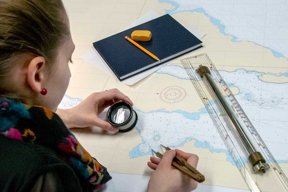
How to manually update your paper chart
Learn how to manually update your paper chart in five easy steps. You can also download a printable PDF version of this page.
-
Check the monthly index in Notices to Mariners to find out if your chart has been updated. The Notices to Mariners web site also provides PDF patches of chart updates that you can print and glue onto your paper chart.

-
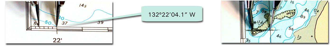
Plot the latitude co-ordinate on the chart border using dividers. Mark this distance on the chart.

-
Plot the longitude co-ordinate on the chart border using dividers. Mark this distance on the chart.
-
Use Chart 1 Symbols, Abbreviations and Terms Used on Charts to help find the symbol of the required change. Add the symbol at the intersection of latitude and longitude.

-
Apply the notice date on your chart in the appropriate location.

Report chart discrepancies
We want to hear from you. CHS relies on mariners to notify us when dangers to navigation are discovered, or corrections to charts and publications seem necessary. It's important to provide us with as much information as possible so we can make the changes and ensure safe navigation for all. Fill out our marine information reporting form which will automatically be sent to chsinfo@dfo-mpo.gc.ca.
- Date modified: